Other posts
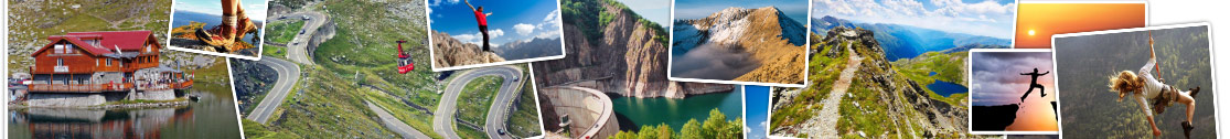
Crossing over a length of 151 km, from north to south, Fagaras Mountains, the highest mountain range in Romania, which is part of the Carpathians, DN7C called Transfagarasan is a spectacular highway which connects the historical region of Wallachia and Transylvania , built between 1970-1974.
read more...
In the list of the oldest medieval Romanian monuments enroll also cave churches in the monastic complex from șinca Veche, settlement located at 45 km from Brasov, 22 km from Fagaras and 3 km from the șinca village, known place thanks to historian and philologis Romanian Gheorghe șincai, family which has its roots here.
read more...
Tourist map of Fagaras Mountains includes points of interest such as cities, communes or villages, chalets and hotels; on the sign of red cross are marked tourist huts and Rescue alerting points and other markings are for resting areas and camp sites recommended. The infrastructure is diverse signaled track / forestry / train stations, European and national roads - with or without upgrades, trails with route number. There tourism signs also indicate tunnels, cable car, monument, peak, saddle, isolated rocks, caves, rivers, dams, forests, nature reserves and resorts, ruins, sheep, etc.
read more...